Skip to content
AV ScannerNews
FeedMapAreasScanner Codes
Submit a Tip
LIVE0 posts today · Latest: Fire on 90th Street East between Avenue L and Avenue K just…Synced 11m ago
AV Scanner News

Antelope Valley's source for real-time incident tracking, scanner codes, and community news.

admin@avscannernews.com
Get the app
Download on theApp StoreGET IT ONGoogle Play

Categories

  • Crime
  • Accident
  • Community
  • Missing Person
  • Fire
  • Traffic
  • Weather
  • General

Quick Links

  • Contact Us
  • Latest Posts
  • Scanner Codes
Lancaster Sheriff Station(661) 948-8466Palmdale Sheriff Station(661) 272-2400City of Lancaster(661) 723-6000City of Palmdale(661) 267-5100CHP After Hours(323) 259-3200CHP AV(661) 743-6060

© 2026 AV Scanner News. All rights reserved.

PrivacyTermsBuilt by Kernforge
FeedMapCodesTip
← BACK TO FEED
Weather

SEVERE STORM AND FLOODING ALERT - LANCASTER/LAKE LOS ANGELES The Lancaster Sheriff’s Station is currently responding to multiple vehicles trapped in flooded roadways due to severe storm conditions.…

Wed, Dec 24, 2025 · 10:20 PMNO LOCATION EXTRACTED
SEVERE STORM AND FLOODING ALERT - LANCASTER/LAKE LOS ANGELES The Lancaster Sheriff’s...

SEVERE STORM AND FLOODING ALERT - LANCASTER/LAKE LOS ANGELES
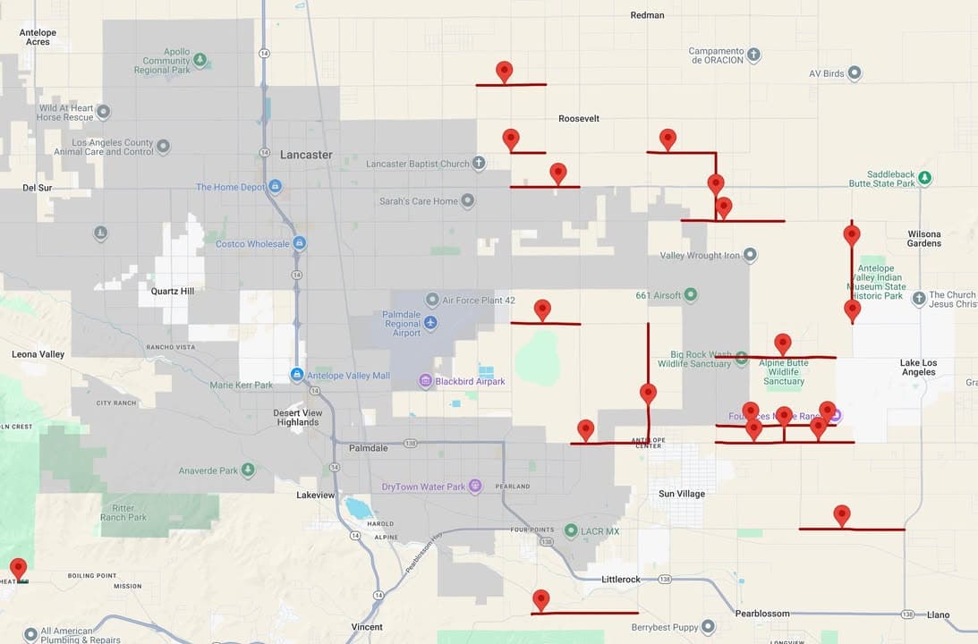
The Lancaster Sheriff’s Station is currently responding to multiple vehicles trapped in flooded roadways due to severe storm conditions.

Do not drive on flooded roads. Do not ignore road closure signs or barricades. Avoid travel in Lake Los Angeles and East Lancaster. SEE BELOW FOR REUNIFICATION INFORMATION.

There are dozens of active road closures, and multiple rescues are currently in progress, placing members of the public and first responders at risk. If a road is closed, do not attempt to drive around barriers or through standing or moving water. Even shallow water can sweep vehicles away. LA County Sheriff's Department field personnel, AV Search and Rescue, and partner agencies are actively deployed. If you do not need to be on the road, please stay home until conditions improve.

For the most up-to-date road closure information, visit: https://pw.lacounty.gov/roadclosures/list_closures.cfm

REUNIFICATION INFORMATION

A reunification point has been established for individuals impacted by today’s severe storm, flooding, and vehicle rescues. Do not call the station for this information.

Reunification Location: Jackie Robinson Park 8773 East Avenue R Sun Village 93543

Individuals who have been rescued or displaced are being directed to this location by public safety personnel.

If you are attempting to locate a family member or loved one: • Proceed only to the reunification location listed above • Follow instructions from law enforcement and fire personnel • Do not attempt to access flooded or closed roadways

Do not self-deploy to active rescue scenes. Emergency responders are continuing rescue operations and will transport individuals to the reunification point as conditions allow.

Additional rain is forecasted for midnight tonight (12/25/25 00:00hrs).

Additional updates will be provided as conditions change.

For emergency resources and additional information, visit: https://lacounty.gov/emergency/
More in Weather
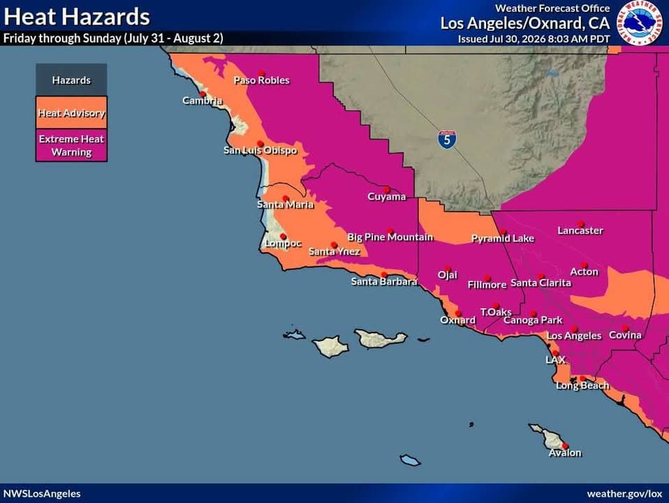
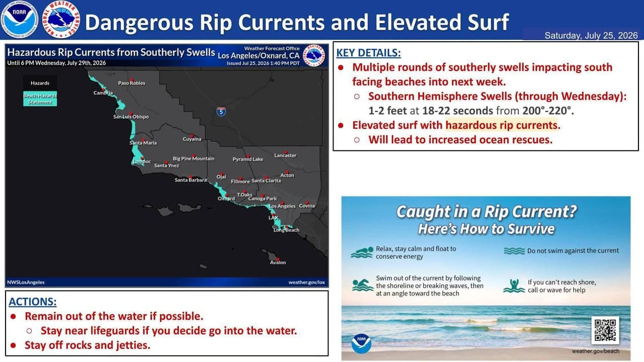
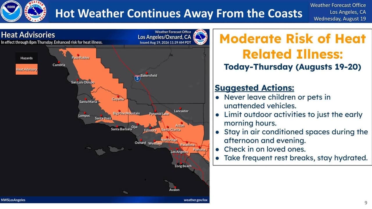
2:59 PM7d agoWeatherHere are the highest temperatures forecast for Southwest California Friday through Sunday.……Heat Advisories and Extreme Heat Warnings are in effect for most the area during this time. Use extra caution to stay safe in the heat! Stay hydrated, check on others and NEVER leave kids or pets in a parked car! Outdoor workers take rest breaks in the shade. Provide shade and water for outdoor animals5:08 PM12d agoWeatherWell, Summer heat will continue to be the main story this weekend……and throughout next week for Southwestern California. Today through Monday, moderate to high heat risk is expected for most areas and Heat Advisories are in effect for most areas and even a Extreme Heat Warning for the Antelope Valley. There will be a "slight" break in the heat on Tuesday and Wednesday. However, even more intense heat is possible the second half of next week into next weekend. So, please exercise caution in this heat. Stay well hydrated, limit outdoor activities during the peak heating of the day and check on sensitive family members and neighbors. If you are looking to go to the beach to "beat the heat," please be very cautious. A combination of swells from Hurricane Fausto, as well as the Southern Hemisphere, will generate elevated surf across south and southwest-facing beaches as well as very strong and dangerous rip currents. Make sure to follow directions from local lifeguards at the beaches. Finally, there will be an elevated to brief critical fire weather risk for the area due to the combination of the heat, low humidity, gusty winds and dry fuels. Any grass fires will spread very quickly. Deep mixing heights (10000-16000 feet) will bring the potential for significant, plume-dominated, fire behavior. So, be careful with any ignition source and have a plan if a wildfire breaks out near you. Try to stay cool out there, Southern California, and have a great weekend!!!!!!!!!!!!!!!!!6:55 PM16d agoWeatherAn extended period of high temperatures is expected this coming week, hottest……Thursday through next Monday. Interior highs will be 98-108 with warm overnight lows. Heat Advisories are in effect for most areas away from the immediate coast, with an Extreme Heat Warning for the Antelope Valley. Use extra caution during this time, check on others and remember: never leave kids or pets in a parked car. Also not a great time to hike with your dog!
SourceView original post on Facebook
PostedDec 24, 10:20 PMImportedMar 22, 7:13 AMCategoriesAuto · WeatherLocationNot extracted